Dettifoss and Ásbyrgi from Hótel Laugar
Europe’s most powerful waterfall and the horseshoe canyon said to be the hoofprint of Óðinn’s horse, both in Vatnajökull National Park, about an hour and a half from the hotel. Allow a full day for both.
- By road
- 90 and 100 km
- Drive
- 1 h 20 and 1 h 30
- Time needed
- A full day for both
- Best
- June to August
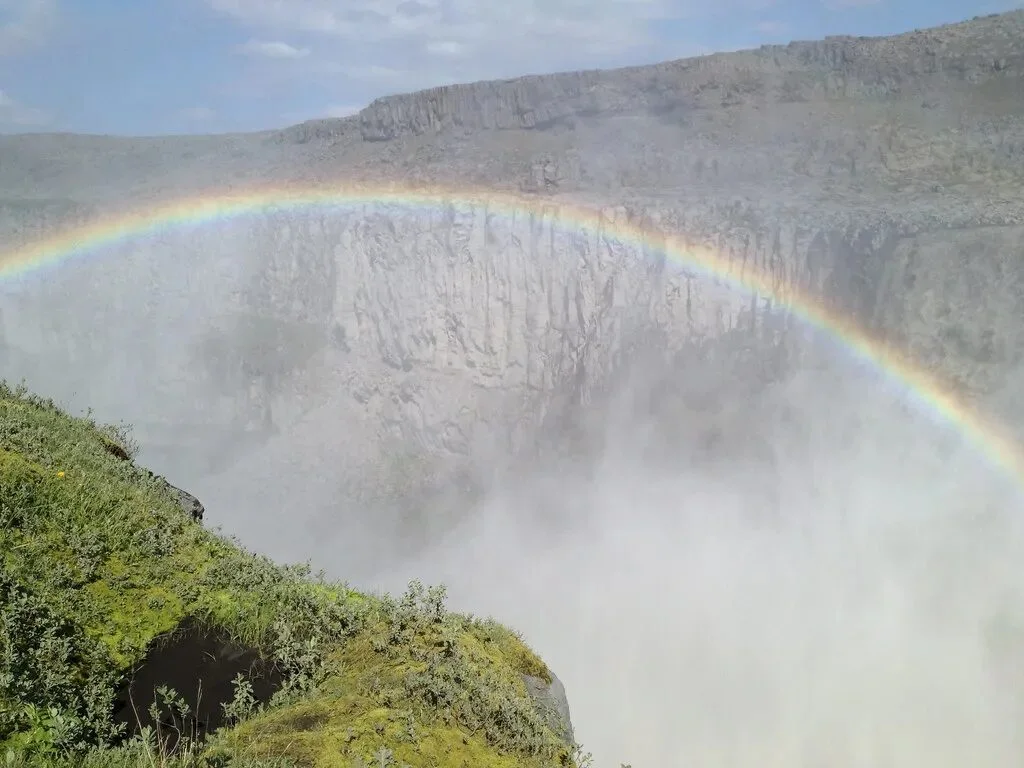
Dettifoss is the glacial river Jökulsá á Fjöllum dropping into its canyon, a hundred metres wide and forty-four high, grey with silt and loud enough to feel through the ground. From Laugar, drive about an hour and twenty minutes east along the ring road past Mývatn, then north on the paved road 862. From the west bank car park, walk fifteen minutes to the edge. Selfoss, a lower, wider fall, is a short walk upstream on the same path; the park’s loop takes in both in about an hour.
Ásbyrgi is the same river’s work from an earlier age: a horseshoe canyon three and a half kilometres long, with cliffs a hundred metres high. Birch and willow cover the floor, with a still pond beneath the rock at its far end. In legend, the canyon is the hoofprint of Óðinn’s eight-legged horse Sleipnir. The visitor centre, Gljúfrastofa, stands at the entrance. From the inner car park at the end of the canyon road, the circular walk to the pond, Botnstjörn, takes about half an hour.
The river and road 862 connect the two. The road is paved along the west bank from the ring road, past Dettifoss to Ásbyrgi. Make a loop from Laugar with Dettifoss first and Ásbyrgi second, or reverse it, taking in Húsavík and the whales on the way north. Allow a full day either way.
- Which bankThe west bank, road 862, is paved from the ring road past Dettifoss to Ásbyrgi and gives the classic view. The east bank, road 864, is gravel, summer only, and quieter.
- WalkingFifteen minutes to Dettifoss on a rough path, about an hour for the loop to Selfoss and back. In Ásbyrgi, about half an hour for the circular walk to the pond from the inner car park, or longer walks up onto the rim.
- HljóðaklettarAt Vesturdalur, south of Ásbyrgi, the river has exposed the twisted basalt columns of old volcanic vents. There are marked walks among the rocks, from the short route to Tröllið to a longer circuit. Stay on the marked paths to protect the vegetation.
- HafragilsfossDownstream of Dettifoss, another waterfall drops into the canyon. On the east bank, a short access track leads to a view of the falls. Road 864 is the gravel eastern approach; road 862 is paved on the west bank.
- Check the roadRoad 864 closes with autumn snow and reopens only when conditions allow and the ground has dried. Check umferdin.is before setting off; road 862 has limited winter service too.
By road from the hotel
90 and 100 km · 1 h 20 and 1 h 30
Measured on OpenStreetMap roads, October 2026
Hótel Laugar is the red square, Dettifoss and Ásbyrgi the blue pin.
Directions from the hotel (Google Maps, opens in a new tab)
Pairs with
Questions
How far is Hotel Laugar from Dettifoss and Ásbyrgi?
About 90 km to Dettifoss and 100 km to Ásbyrgi, an hour and twenty minutes to an hour and a half by car. Dettifoss is reached from the ring road past Mývatn on road 862; Ásbyrgi from the coast road beyond Húsavík.
Can I visit Dettifoss and Ásbyrgi in one day from Hotel Laugar?
Yes. Together they are a full day, about 225 km of driving as a loop on paved road 862. Dinner at the hotel is served from 18:00 to 21:00.
Is there a short walk at Hljóðaklettar?
Yes. The marked route to Tröllið is 1.2 km there and back, about half an hour. The longer Hljóðaklettar circuit is 3 km and more demanding.
Is the road to Dettifoss paved?
Yes. Road 862 on the west bank is paved from the ring road past Dettifoss through to Ásbyrgi. Road 864 on the east bank is gravel and open in summer only; check umferdin.is.
Two to four nights in Laugar
Dettifoss and Ásbyrgi are 90 and 100 km by road, and dinner is served from six. Book direct for our best available rate.
You finish on the hotel’s own booking page.